Cycling in the Carolinas and a Visit to PARI

Mike and I joined the Waterloo Cycling Club on their annual pilgrimage to South Carolina for a week of training camp. I was a bit of a hanger-on: the training camp is primarily meant to get the race team into shape for the season, although families do come out.  In other years, there are a few more casual riders, but this time things didn’t quite work out that way.  

First, the riding: I was a little bit stressed out about my abilities compared to the rest of the attendees, especially because I had limited pack riding skills and my fitness was not good. Working as a surveyor and spending all week on my feet means I’m often too tired to do much riding, other than casual paced coffee rides on weekends. This was exacerbated by coming down with a cold on the first day! Nevertheless our housemates were wonderful and understanding. One member of the race team gave me a piece of advice I have often applied since. Basically, that the world is beautiful and you should do whatever you need to experience it. If that means driving to the start, or part way into a planned route and meeting everyone, or riding solo, or whatever. Do something! Don’t miss out on what you CAN do because you are focussed on how you can’t measure up. So I did. I started a ride with the group, met them half way a couple of times, and on one epically long day, offered to drive to set up a rest stop with another less-serious cyclist, and ride from there. 

I started the day with the group and then solo-ascended Ceaser’s Head.

PARI and the Blue Mountains: The race team did an epically long ride, from our camp to the Blue Ridge Parkway, and then sweeping back. My friend Tasha and I offered to drive to the top of the climb up to the parkway, with drinks and food so that the team could carry less water. The team left early and we slept in, packed a cooler and then drove out. Winding through the Pisagah Forest and chatting, we suddenly passed a sign for PARI, the Pisgah Astronomical Research Institute.  Oh my! I hadn’t made the connection that we’d be so close to PARI, I exlaimed. I then explained that my mother’s colleague from the David Dunlap Observatory in Richmond Hill, Dr. Mel Blake, had taken a job there after completing his Ph.D., later moving on to become a professor at the University of North Alabama.  We decided after our ride along the parkway, we’d pop in and see if we could have a look around. After all, radio telescopes are pretty cool.

We met the crew at the top of their climb, and chatted with everyone as they took on water, food and pickle juice. Then we got our own bikes out for a cruise along the highway. The views were beautiful, and it was definitely worth bringing the bikes along! Once we finished our ride, we headed back to the car and made our way back through the forest to PARI. We got there just before close, and had enough time to take the self-guided tour as long as we were out before the gate closed, we were good to look around. I was pleasantly surprised to see Mel in the exhibit’s welcome video!

PARI is a very interesting place. It began in the ’60s as the Rosman Tracking Station, used by NASA to communicate with satellites and manned spacecraft. The western 26 m telescope received the first true colour photograph of the full Earth from space (taken by the ATS-3 satellite), predating the famous ‘blue marble’ photograph of the Apollo 17 mission, and the station’s telescopes received the first TV transmission from space in the same year.

ATS-3 image of Earth
The ATS-3 Image of Earth received by the Rosman dish at what is now PARI.

Later on, during the cold war, the site was used by the DOD. It was at this time the 4.6 m dish on site was painted with a smiley face for the benefit of Soviet satellites. The DOD ended their operations at the site in 1995 and the site was acquired by Don and Jo Cline, who converted it into the PARI facility that exists today. Since 2003, ‘Smiley’ and the site’s 12 m telescope have been available for use over the internet – they are some of the few radio telescopes in the world that are controllable this way!

We enjoyed the exhibits, and walked around the grounds briefly before heading out to meet the cyclists back at camp. I was pleased with how it all worked out; I followed the advice to cycle in a way that worked for me, helped the gang out at a rest stop, and squeezed in some unexpected astronomy. That day in the Blue Ridge Mountains was my favourite of the trip!

The PARI Campus with Smiley and the west 26 m telescope.

Finally Complete: (1974?) Revel Cutty Sark

I’ve completed another model! Last winter, my modelling took a turn for the nautical. I started a complicated project from my father-in-law, and picked up a simple kit while visiting my sister-in-law in North Carolina to work on as a break.

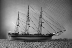
The complicated project was a (1974?) Revel Cutty Sark at 1:96 scale. It was originally gifted to my father-in-law by his father, and had been waiting patiently in the basement for someone to assemble it ever since. I said I’d do it, but that it belonged in Port Hope, so I’d be bringing it back when complete. Last winter, I got through most of the hull construction. It was very different from any of the other modelling I’ve done before – usually I don’t take on projects that need much paint.

This winter, I took the model out again and worked on the masts and rigging. The model kit was designed to be displayed with either sails billowing or sails furled. It took a while to decide, but in the end the model’s plastic was aged enough that many of the pins were too brittle to tie rigging to, so I just did the standing rigging and left the rest. I think it turned out pretty well:

Now all that remains is taking the Cutty Sark back to Port Hope so it can take its rightful place in my father-in-law’s garage. I just need to figure out how to get it there in one piece!

Taiwanese Reunion – Keeping it Weird in Portland

Friends of ours from Taiwan, Gavin and Pamela were planning to take summer holiday visiting Gavin’s parents in Vancouver, Washington. We were about ready for a vacation and they suggested we come and visit too! If there’s one rule for a good trip, it is spend time with locals, so of course we took them up on it!

Gavin’s parents were wonderful people, and very accommodating to have a couple strangers in their house. And Gavin was a wonderful tour guide. We spent a bit of time in Portland, taking in a few breweries, a trip downtown, a visit to REI and we window-shopped Voodoo Donuts, but the lineup was massive and there was too much to do, so we didn’t actually try one. We did however make more than one trip to King Burrito, a local legend that deserves a line at least as long as the one at Voodoo Donuts (although I’m glad the line there was shorter).

As much as Portland was fun, the best parts of the trip were driving around where Gavin grew up. He’s a “spot” guy (as in, “I know this spot…”), and so we checked out all the places he’d go with friends to pass the time.

Gavin takes us to another spot...

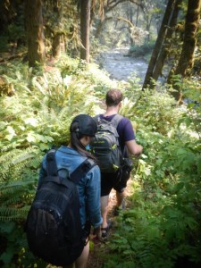
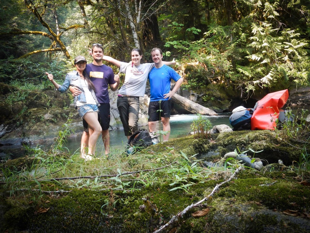
One of the places he brought us to was a a camping site near Mt. St. Helens, and did a bunch of hiking and exploring. I was absolutely fascinated by the geology of the area. Lava tubes are so intriguing and the stratigraphy is amazing! We also took a trip to a beautiful waterfall. The water was crisp and cold and Gavin warned us about jumping straight in. Boy was he not kidding! The water was so cold my muscles seized up and I pretty much had to get out right away.

The intrepid campers stand in front of the waterfall...

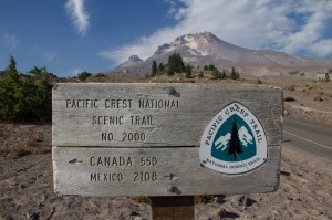
We had planned to stay with them only a few days and then go on a little road trip of our own, so they could have their family time. We started with Mt. Hood on the way to an overnight in Bend.

Pretty far from home, but still making it on the signpost!

Bend was a surprise and we were both wishing we brought bicycles there. We had more good beer and a nice dinner and a walk around. The plan had been to head to Crater Lake, but it was thwarted by raging wildfires. All but one entrance to the park were closed due to fire, and it seemed like entering the park knowing all other exits had been blocked by fire was asking for trouble.

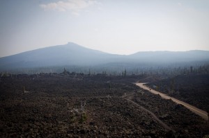
Instead we decided to cut back to the coast, via the Willamette National Forest. That meant driving through a massive lava flow and stopping for the view at Dee Wright Observatory. This is a neat stop – the lookout, which is made out of the surrounding bassaltic andesite, was constructed by the Civilian Conservation Corps during the Great Depression. It is a curious structure, and the interpretive trail is worth the walk (bring water!). The area was used in 1964 by NASA as a moon analogue training ground. Definitely worth the stop!

Lava Flow at Dee Wright Observatory

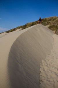
We had another pit stop a few hours later to stretch our legs, cool our feet off in the ocean, and explore the Oregon Dunes. I was expecting dunes on the order of what we have at Sauble Beach, and so I was very surprised when we got there. These dunes were amazing! They were fun to climb, although it was a bit harsh to be out there when the wind picked up. All in all, it was a very geological day.

The Oregon Dunes

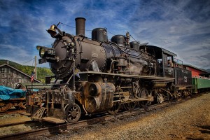
Our last stops before returning to Portland to catch a flight home were the Oregon Coast Scenic Railway which runs between Garibaldi and Rockaway Beach, and and a visit to the Tillamook Creamery to see how cheese is made. The train trip was fantastic – I LOVE a good train trip and this one had good scenery and a steam engine! It isn’t too long, but the stopover is just enough to do a little exploring, and so it makes for a very nice small outing. And the Creamery was interesting too – they have turned it into quite the informative tourist attraction. And of course we got some ice cream and bought some cheese to snack on.

Oregon Coast Scenic Railway - Did I mention I like trains?

And then it was over! We drove back to Portland, grabbed one last meal from King Burrito on our way to a cheap hotel by the airport, and prepared for the long trip home. I’m sure we’ll be back – there’s a lot more to see!

Missing the hot springs of Taiwan (and Japan)

A long cold winter has me pining for the wonderful warmth & relaxation that comes from a day visiting hot springs.

My first exposure to hot springs was the onsen culture of Japan.  Starting slowly, at an indoor facility in Osaka called Spa World (check out Mike’s review here), both Mike and I quickly got over our reservations about being naked in (gender segregated) public, and became onsen converts!  After Spa World, we took every opportunity we could to relax in the lovely hot water.

Taiwan is very tectonically active, and one of the consequences of this is a multitude of geothermal hot springs, and a hot spring culture that is very similar to that in Japan.  A visit to the steamy waters is especially welcome during the rainy winter.

Beitou is one of the most famous examples of hot springs in Taiwan, and Mike and I really enjoyed our visit there.  It was especially fun, because not only can you enjoy a soak in wonderful warm water, but you can take a walk down to the geothermal pools of the Thermal Valley, something we weren’t able to see for ourselves in Japan.  The hot spring pool is stunning, with temperatures reaching 100°C, and pH values as low as 1.2. You can smell the sulphur well before you can even see the steam rising from the surface of the hot spring pools.

The valley is the discovery site of hokutolite, a variety of the mineral barite.  Hokutolite was discovered in 1905 by a Japanese mineralogist, and it only forms in hot spring environments.  The mineral gained a reputation for having curative powers, and was removed from the valley in large amounts.  Unfortunately, while it doesn’t have any curative powers, it does precipitate at a very slow rate. It was removed in such quantites that the mineral is now protected, and the best examples in Beitou are at the Beitou Hot Spring Museum.

On our visit to Beitou, we first took some time to walk around the town, and then we rented a spa room for a couple of hours for a mid day soak and rest. Beitou is a really enjoyable and easy day trip from Taipei – the Xinbeitou station is within easy walking distance of all the fun. I highly reccomend a trip to the area for anyone who hasn’t experienced hot springs, or is looking for a neat day trip away from Taipei.

And as for me, perhaps there will be a visit to the Scandinavian Spa at Blue Mountain in my future…

Earthquakes!

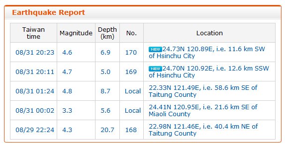
Although there were (very) minor earthquakes while I lived in Toronto, I cannot say I ever felt one. My experience in Taiwan, however, was a completely different story. Located near the ring of fire, earthquakes are very common there. In fact, it only took about a month to experience one! I was so excited, I even took a screen shot of the reporting online (the two events marked “new” in the image below):

The first two earthquakes I ever felt!

Although a very minor event, I still remember it clearly. I was at home, on the 8th floor of an apartment building. The sensation was something akin to being on a very big boat, and the TV wobbled dramatically on its swivel stand. I must admit that I had not considered the proper actions to take in the event of an earthquake before the event, and I was quite relieved when the shaking eased off. I decided I should do some reading on earthquake preparedness for next time, when a second event occurred only a little more than 10 minutes later! Interestingly, Mike, who was out on a scooter at the time, felt nothing.

Although common events, the vast majority of the earthquakes we experienced were magnified by the elevation of our apartment and would have been difficult to detect at ground level. We also discovered that they are much easier to detect lying down than standing up, and it is quite difficult to discern a tremor from rough pavement when driving. Still, we experienced two events that were easily felt on the ground-floor in Hualien, a very seismically active area. This was a much different experience than being elevated – it was much rougher, and felt more like the Earth was cracking apart, rather than a gentle sway.

I am thankful for my easy earthquake experiences in Taiwan – thrilling and consequence free. According to the Central Weather Bureau, Taiwan experiences 2200 earthquakes a year on average, about 200 of which are felt on the ground.  And occasionally they are devastating.  Case in point, an earthquake registering 7.6 on the Richter Scale, that occurred on September 21, 1999, now known as the 921 Earthquake. The 921 Earthquake occurred along the Chelongpu Fault in Nantou County.  More than 2300 people were killed, and thousands of others were injured.  Thousands of buildings were damaged, and a 7 m waterfall was created by movement on the Chelongpu Fault. A high school lying on the fault line has been converted into the 921 Earthquake Museum where tourists can learn about earthquakes and disaster preparedness, and see some of the damage of the 921 Earthquake first hand.  We never made it out there, but I would try to go the next time I’m in Taiwan.

Bonus:

Want to follow seismic activity in Taiwan? Check out the Central Weather Bureau’s Earthquake page.

The Effects of Altitude

Taiwan’s mountains are huge! Seeing the peaks poke through the clouds flying in and out of Taipei gives you a little taste of their size, but even more impressive is their highest mountain pass. The highest mountain in Taiwan is Yushan (玉山) at 3952 m, and the highest mountain pass crosses Hehuanshan (合歡山) at 3275 m. In contrast, while Mt. Logan, the highest mountain in Canada, tops out at 5959 m, the highest mountain pass (Highwood) is at a measly 2206 m.

Mike and I enjoy a good hike up a mountain, and tackle them whenever we can.  Sadly, we were too early in the season to attempt Mt. Fuji, but we did summit Hallasan on Jeju Island, South Korea. Check out the graphic to compare some of the peaks we’ve summited, and the highest peaks in Canada and Taiwan.

Comparing the heights of various mountains we've summitted, and the highest peaks in Taiwan and Canada.

As part of our time resting and exploring Hualien, we rented scooters and drove up to Wuling and the Hehuashan pass. The drive from Hualien to the top is about 100 km of engaging driving and stunning scenery. The marble canyons and gushing river at the foot of the mountains give way to precarious and seemingly never ending winding roads and tunnels further up. Finally, the forest gives way, and scrub takes over. The last 10 km of driving or so looks like it could be Wales or somewhere in Newfoundland.  It is interesting to note that despite the altitude, the peaks are not perennially snow-capped.  Still, anyone curious about the white fluffy stuff can visit in the winter months and hope for a heavy snow fall.

At such a high elevation, the reduced amount of oxygen in the air noticeably affects the performance of your scooter. So much so that you nearly have to push it up some of the inclines! I didn’t notice the effects on my breathing while I was driving, but I felt light headed and winded the moment I parked and started walking. At the mountain top resorts, there were plenty of signs indicating medication for acute altitude sickness was available, and I can see why. Altitude effects are quite common over 3000 m, and Mike felt it too. I still can’t believe Mike cycled to the summit the very next day – a physical challenge even without the thin air!

Our time on Hehuanshan is the only time I have ever felt the effects of altitude, and it stands out as an amazing experience in Taiwan.  I certainly have a newfound respect for mountaineers!

Rainy Days, the Monsoon and Taiwan

The word ‘monsoon’ may conujure up images of warm tropical rains, however the term monsoon refers to a seasonal wind that reverses direction during the year. The summer monsoon is typically a rainy season, whereas the the winter monsoon is typically dry. This is because during the summer, the Asian landmass gets heated by the Sun. This creates a low pressure zone over the land that draws in wet oceanic air which results in heavy rainfall and potential flooding. In the winter, the system reverses itself. As the land cool down, a high pressure system develops and cold dry air is pushed out toward the ocean.

Seasonal changes in the East Asian monsoon area, from Yi, 2011

In Taiwan, this story is complicated by the Central and Xueshan mountain ranges. The winter monsoon is blocked by these mountains, resulting in cloudy weather and orographic precipitation over northern Taiwan during the winter months, while southern Taiwan stays dry. The summer monsoon is rainy throughought Taiwan, and can be divided into three components. First, there is a rainy period in May called 梅雨 (Meiyu = Plum Rain). This is followed by a break in the rain, and then another rainy period that extends from July to September.

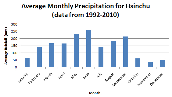
The winds were a big player in our decision to travel clockwise around the island when we went on our cycling trip – depending on the season, it can be better to go one way or the other. The rains that come with the summer monsoon were also pretty neat. Every afternoon you could count on a downpour (better keep a poncho in the scooter boot)! Hsinchu is in the north, so we also experienced winter monsoon rains. These were a little less enjoyable since getting wet in the 10 degree weather would sometimes get a little chilly. I worked out early on that flip-flops were a great alternative to dealing with wet running shoes during the winter rains. Here’s a chart showing average monthly precipitation in Hsinchu, prepared using data from 1992-2010 from the Central Weather Bureau:

Average Monthly Precipitation for Hsinchu from 1992-2010.  Data from the Central Weather Bureau.
Average Monthly Precipitation for Hsinchu from 1992-2010. Data from the Central Weather Bureau.

Extra reading: some neat papers about precipitation in Taiwan

Rain, wind and waves… Typhoons!

Typhoon Soulik (image credit: NOAA)
Typhoon Soulik dwarfs Taiwan (false colour, image credit: NOAA)

Typhoons are the the Northwestern Pacific’s equivalent to the hurricanes that occur in the Northeastern Pacific and Atlantic. They are formed when a number of factors (including a warm ocean and an existing weather disturbance) come together. When a typhoon makes landfall, it can bring high winds, torrential rain, huge waves and flooding.

Heavy rains and the occasional windy weekend were all the effects of hurricanes I ever experienced in Ontario, but I did experience Hurricane Igor in St. John’s, Newfoundland. While the storms themselves are similar to what Igor was, the frequency with which they arrive is amazing. There have only been 13 hurricanes that made landfall in Newfoundland since 1775, but Taiwan experiences about 2 or 3 a year! This, of course, means that there is much infrastructure put in place to deal with such storms, such as huge floodways and bridges that seem to be taller than one might think they need to be.

We experienced a few typhoons, the most serious of which was Soulik, which caused 4 fatalities, and among other things, the largest offset ever recorded at the mass damper in Taipei 101. For us, the winds seemed similar or less severe than those we experienced during Igor, but the amount of rainfall was absolutely astounding.

Comparing Igor and Soulik:

Igor
St. John’s Airport
Soulik
Hsinchu
Total Rainfall (mm) 120 823 (Bailan Township)
Peak Wind Gusts (km/h) 137 104

You can track typhoons near Taiwan through the Central Weather Bureau Typhoon Advisory page.

Check out excellent photographer (and my soccer teammate) Colin Peddle’s photojournal capturing the destruction of Hurricane Igor and a BBC summary of Typhoon Soulik (plus video).